Synthetic-aperture radar satellites complements other technologies used to assess natural catastrophe damage, and ICEYE plans to use its growing satellite constellation to prevent flood damage when possible, as well as detect it.

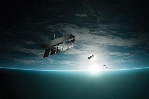
ICEYE is focused on synthetic-aperture radar (SAR) technology, which has the ability to see through darkness and weather to provide a round-the-clock capability to map even slight changes in terrain, proving itself useful for natural catastrophe re/insurance applications.
The Microsatellite manufacturer and operator announced in December a joint venture with Emirati partner Space42 to manufacture satellites in the UAE. The new agreement expands on the two production centres already set up, manufacturing satellites from the company’s Finnish headquarters as well as from its US base in California.
Barely a week later, ICEYE announced it had closed a $65m extension of its earlier growth funding round of $93m, announced in April, for a total of $158m raised in 2024, surpassing $500m in the firm’s history. The recent extension included investment from funds managed by Solidium Oy, BlackRock, Seraphim, Plio Limited, and Christo Georgiev.
The Finnish company has also kept up a steady stream of satellite launch announcements in the past year. Each new satellite has a launch mass of under 100kg (220lbs).
More than a dozen new satellites have been launched over the past year, bringing the constellation to a total of 40 satellites in orbit at the end of 2024.
Stephen Lathrope is senior vice president, solutions, ICEYE, one of three divisions at the company, working closely with commercial re/insurance sector clients. The company’s satellite launches take place on a ‘ride share basis’, Lathrope explains, booking slots to launch the SAR satellites, typically with Elon Musk’s SpaceX.
“We continue to have the largest constellation of satellites that have this SAR capability. That’s unchanged, but what has changed radically is the fact that our latest generation of satellites are so much more powerful and can operate in tandem with other satellites in the fleet,” he says.
ICEYE doesn’t talk much about the other two divisions, as these “missions” and “data” elements are highly confidential and in many cases working for government and intelligence organisations. However, the solutions arm is turning the technology to the needs of the re/insurance sector.
“There’s a lot more capacity now, which has a direct impact on the richness of data,” Lathrope says. “The global nature of coverage means we’re well equipped not just to deal with the increasing unpredictability of frequency and severity, but also where these things happen.”
Flood has been a major focus, with Tokio Marine being a major user of its Flood Insights capability, and also an investor in the company.

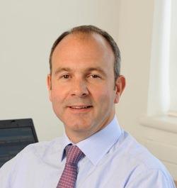
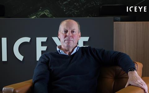
Lathrope (pictured, left) talks about floods in Brazil in 2024, which displaced half a million people from their homes, as an example of the technology’s utility, in an area lacking the infrastructure for more traditional methods of assessing damage.
“We can see night and day through whatever the atmospheric conditions” he says. “That flood event lasted a few days and was over 30,000 km2. There isn’t enough imaging capability available anywhere else, other than in our constellation, that can deal with those conditions.”
The satellites are typically launched into a specific orbit to cover a pre-selected part of the globe, but because they are launched with thrusters fitted to them, they can be moved to a limited degree, adjusting their orbit, if or when required.
“We have had occasion to do that, but we don’t do it a lot. For flood risk, that’s because we revisit most of the places we focus on about six to eight times per day, so we’re typically able to capture hundreds of images for flood event areas over a few days.” Lathrope says.
The business model involves building satellites continuously, which Lathrope speculates is likely to accelerate the numbers that are put in orbit.
Lathrope “spends more of his time on the cross-industry data solutions”, whereas his colleague Rupert Bidwell, vice president and global head of insurance, ICEYE, is more focused on providing nat cat data for the insurance and reinsurance industries.
This year ICEYE launched Flood Rapid Impact, which is focused on the extent of flooding, delivered within 12 hours of the start of the flood and then at 8 to 12-hour intervals thereafter, aimed at giving insurers the capability to track the progression of floods.
“It’s faster by an order of magnitude than previous flood insights, which focused on depth, and providing something nearer to a real-time feed of where the water is,” says Bidwell (pictured, right).

The SAR imagery captures where the flood water is, while the water depth is derived from a combination of the image and digital terrain elevation models, as well as other auxiliary data sources such as river gauges and media reports..
The new product is being pitched, mostly to primary market insurers rather than their reinsurers, but across the globe, from the US market, to European underwriters, as well as South African and Australian firms.
“It’s going to open up other use cases for insurers. It’s going to open up more proactive communication; it’s going to open up the possibility of risk engineering interventions; and in an ideal world it will take us to loss prevention,” Bidwell says.
“We’re not there yet, but that’s the trajectory we’re on, because if you can know where the water is today, you can predict where it will be tomorrow, and then do something about it,” he says.
Floods and wildfire are major focuses for the technology.
“We’re going to add earthquake to that, and we’re also going to add wind,” Bidwell says.
Two insurers have been piloting using ICEYE for North Atlantic wind risks for the hurricane season just concluded, which is helping to train the models used for a broader rollout.
Wind risk represents a different challenge, emphasises Bidwell, noting that the technology is complementary to things like drone photography, which can do things SAR images cannot, such as showing colours, which might be useful as an indicator of damage. What is offered through SAR is speed and relative cost efficiency.
“We’re filling in an information void that exists before drones and optical solutions might be able to inspect the damage. They can’t capture everything at scale, and also face problems of clouds and night time. What we can offer is speed and scale,” he says.
He explains the ‘before and after’ approach using SAR for hurricane property damage.
“We’re creating a before and after view of the damage,” he continues. “For building damage from hurricanes, we use pre-imaging of all of the US Atlantic coastline and Gulf of Mexico, so anywhere where it’s likely a hurricane will make landfall. In the days running up to a large event, we re-image the areas where a landfall is anticipated. Then within 24 hours of landfall, we’re recapturing the image, to understand what damage has occurred,” Bidwell adds.


No comments yet